Wednesday, August 10, 2011

"How Did You Even Get Down From There?"

August 5th- August 7th

HAWKE'S BAY


This weekend we decided to take on one of the longest drives we will encounter on one of our 2 day weekend trips on the North Island. We went to the beautiful Hawke's Bay, located on the East Coast of the North Island, an area known for its orchards, vineyards, and food. Hawke's Bay is 310km from Hamilton which ended up being about a 3 and a half hour drive. So far, Scott has been the primary driver on our trips, but this weekend Nikki decided it was time she took to the wheel and brave the New Zealand Highways. Eeeekkk!

In doing some planning for this trip, we came across a concert that was happening on Friday night in the area. It was a Kiwi band called Avalanche City. We had never heard of this band, but after a quick google and listen to one of their songs on YouTube, we shrugged and thought... Why not?

We arrived in Havelock North at the Black Barn Vineyard where the concert took place just in time to pull out the camp stove and make some dinner before the concert. The concert was held in an underground wine cellar.                                                        

Black Barn Vineyard
We weren't sure what to expect. We found ourselves sitting among 150 people of all ages waiting for it to start. Looking around at the people, it was hard to distinguish what kind of concert this was going to be. There were older couples sipping wine, younger girls dancing away in the corner, and of course, some men appearing to be dragged along by their girlfriends/wives.

Entrance to Wine Cellar
It ended up being an absolutely amazing show.

Starting the night out was a singer named Luke Thompson. He mentioned that he usually plays with a band but tonight he was playing solo acoustic. He's got quite an amazing voice.


Avalanche City took the stage after a little bit of a delay because they apparently lost their accordion. I hate it when that happens. They are a six piece folk band: bass and acoustic guitar players, electric guitar/manjo/ukelele player, drummer, keyboard player, and an accordion/violin/glockenspiel player. They are all super talented and their sound is really complex and unique.

Avalanche City at Black Barn Vineyard
 Their entire set was incredible. For two people who have never even heard their music before, we were just as into it as all the other fans, singing and dancing along. They are an excellent band to see live. Here is one of our favorites songs of the night:

 
                      Avalanche City - Go                        

At the end of the concert, instead of the band running off backstage, they stuck around and hung out with the crowd. We had a chance to talk to the lead singer for a little while. He thought it was pretty cool that two Canadians decided to come see his show on a whim. 

Vineyard in the morning
Freedom camping is frowned upon in this region, and we didn't really have anywhere arranged to camp for the night yet. When we got to the concert, we asked the guy in charge and he said we could stay overnight in the vineyard. So all we had to do is walk back to Bertie after the concert and jump into bed. In the morning, we looked out the fogged windows and realized that the band had done the same thing in their bus right beside us. 


Enjoying the morning sun
 The next morning we woke up in the beautiful vineyard, made some breakfast, and went on our way. We heard that a great thing to do in this area is rent bikes and tour around that way. There are multiple companies offering bike tours, which we find out means they will give you a bike and a map with the attractions to stop at, and send you on your way for about $60/person. Or you can get the same maps from the i-site in town for free, and rent a bike from them for $20/person for the day. Obviously some people don't figure that one out or those companies wouldn't exist.

Needless to say, we rented bikes from the i-site, checked out the maps, planned out route to the places we wanted to see, and off we went.


The first stop was really our only 'must see' of the day.

Arataki Honey

Arataki Honey is the number one beekeeping business in the Southern Hemisphere. They have 20,000 hives all over New Zealand. This visitors center teaches you everything you need to know about bees and honey, which is actually quite interesting. We were so enthralled with it we forgot to take out the camera for most of it. They had 12 different kinds of honey to taste too. We left on a little bit of a sugar high... but it was SO delicious.

Our favorite was Tawari honey. It comes from a tree found nowhere else in the world but New Zealand's North Island. The honey is a toffee color with a sweet, buttery, golden-syrupy, nutty flavor.

Yes, we bought some of it, and toast with butter and that honey is yummy! Ok... I'm hungry now.

Next we stopped at Te Mata Estate. They have 600 acres of vineyard, which include 3 of the oldest vineyards in New Zealand, and produce 35,000 cases of wine at full production each year. It is located in the hills just outside of Havelock North, and with an arch bridge entrance, walkways through gardens, fish ponds and courtyards, it is a popular place to stop and check out. Not really our thing, but we were there, so we figured we'd better go check it out.  

Te Mata Estate
One of Te Mata's Vineyards
The next stop we really wanted to see what a place called Te Mata Cheese Factory. Unfortunately it has recently shut down. So, instead we decided to take the bikes closer to the coast and ride along side the ocean in Te Awanga. 
On the beach with Cape Kidnappers in the background
The beaches here are rocky and the break is right up on the beach with gigantic loud waves coming in. There is no surfing here, but watching those waves come in can occupy us for a surprising amount of time.

We played a game of wave chicken, seeing who can stand their ground the longest as the wave creeped closer and closer to us. I know it sounds stupid but these waves were so unpredictable that it was quite a challenge and lots of fun. We never really kept score, but I'm pretty sure Scott gets this win.


Scott playing chicken


After some beach time, we biked to Elephant Hill Estate Vineyard where we stopped for some lunch. We figured since we are in a place that is supposed to be known for it's food, we should do it right.


 Scott's Appetizer:

Manuka smoked eel, vermouth creamed leeks & soft polenta


Nikki's Appetizer:

Duck prosciutto, mozzarella, smoked tomato vinaigrette, olive grissini


Scott's Main:

Grilled spatchcock, goats curd, pancetta, cumin & shallot confit


Nikki's Main:

Lamb & smoked portobello Wellington, truffled potato purée


Not that the food wasn't good, because it was delicious, but our favorite part of the meal was actually the complimentary bread served with olive oil and balsamic vinegar and olives. The olive oil was so good you could literally eat it by the spoonful and the olives were some of the best we've had.


After lunch we rode back along the beach. The sun was setting and getting a little chilly so we set back to return the bikes and call it a day. When we got back to the i-site, we realized we didn't know where to camp for the night again. The guy from the i-site told us we could just park in the lot just down by the grocery store, right in the middle of town. We took his word for it and luckily did not get a knock on the window in the middle of the night telling us to skedaddle.

That evening there was a New Zealand vs Australia rugby game on, so we figured we'd go watch it where the locals would, in a family pub just down the street (I know it seems strange to combine family and pub, but that's exactly what it was... there was even a kids menu). It was quite the experience: everyone in the place was glued to the screen, people ducked when they walk in front of someone, and it was near silent between cheering, and when half time came around, everyone then got up to fill their drinks or go to the toilets. Oh Kiwi's love their rugby.

We awoke Sunday morning to a strangely warm campervan and Scott doing his best Flock of Seagulls impression.
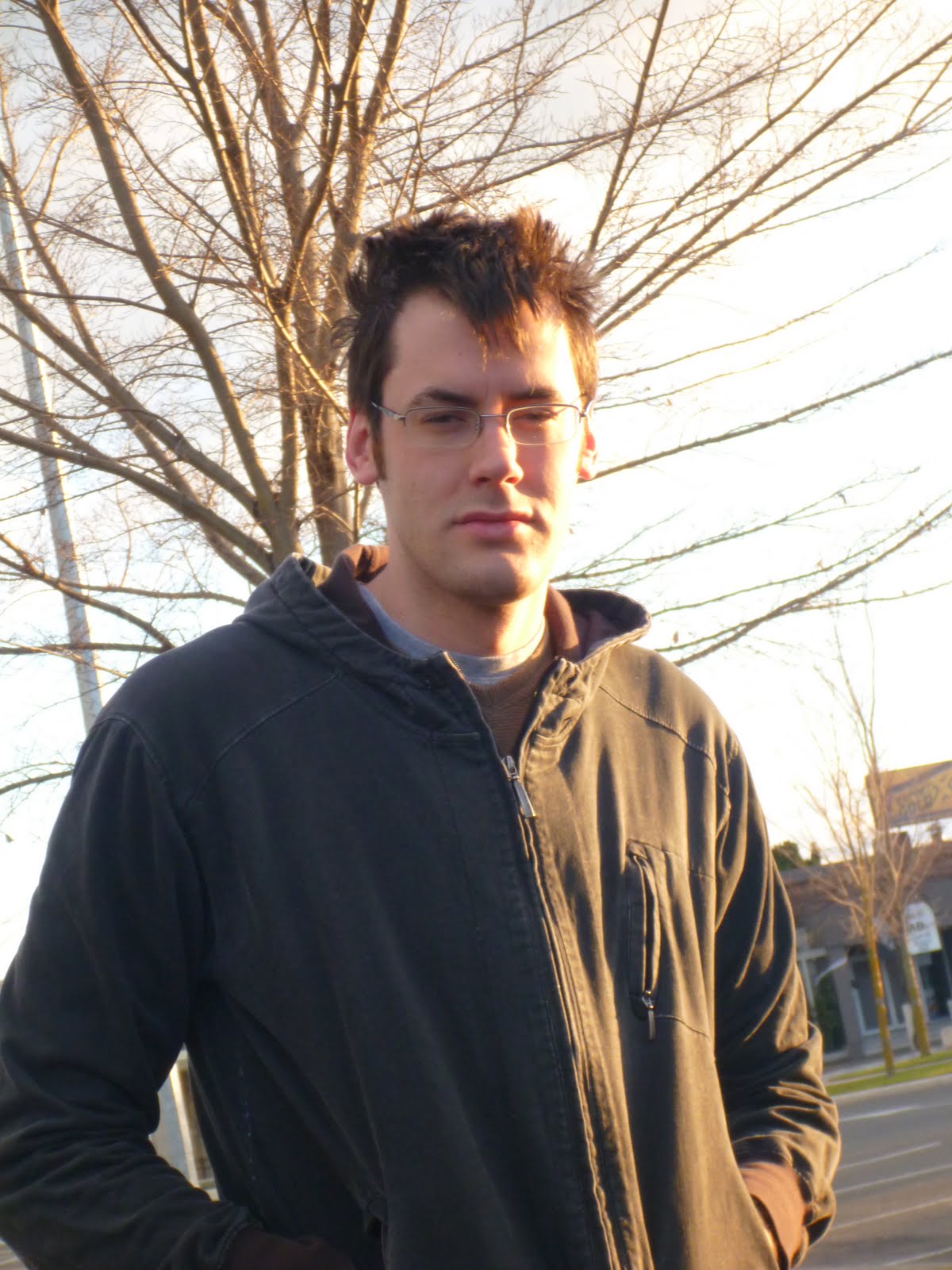

Instead of eating breakfast in the parking lot where we slept, we drove to where we wanted to start hiking from, and parked in a farmer's field. It was warm and clear but the wind was howling, and kept ripping all day long.


The most prominent geographical feature of the region is a long rocky ridge that tops out with Te Mata Peak. One side of the ridge is quite gentle and there are orchards, private estates, and golf courses dotting its slopes. There is even a paved road all the way to the peak. That sounded positively boring to us, so we took a stab at going up the other side, the steep side. As there are no trails or anything, we picked a spot that looked grassy all the way to the top of the ridge, with the intention of following the ridgeline all the way to the peak.

Our route started just to the right of the picture, and followed the ridge to the peak on the left.

The leg from the camper up to the ridge was short, but essentially straight up. We found our way up the grassy slopes at the bottom, through some valleys and spines, up through the trees, and to the ridge.


We came over the ridge from the leeward side to the windward side, and continued along the jagged edge to the south.


The hiking was not particularly hard, but beautiful and interesting. At some points it dropped off in a shear cliff to our left. Most of it was a constant up-down through herds of cows and flocks of sheep, trying to avoid landmines as we went.


We came to a relief in the ridge that would let us get back down into the valley, but we were just shy of the full peak. We looked to the west and saw some menacing looking clouds, so we opted for a sub-peak and dry hiking instead of the summit. From the top we could see the full cirque of Hawke's bay and the Okanagan-like valley that we spent the last 2 days in, reaching all the way to the ocean.


The hike down was, well...steep.


We found a game trail to follow and took our time with the top section. Scott kept on thinking how incredible it would be to have the whole place covered in snow and go powder skiing.

                  Nikki, doing her best mountain goat impression.

We made it safely to the lower slopes, where the angle flattens out a little bit and the eroded rocks and boulders from the ridge come to settle. Beautiful place.

                            HI MOM!!!

A lot of the pictures that end up in this blog have both of us in the frame. This is obviously done with the magic of the self-timer function of the camera. But 10 seconds only allows you to get so far, even if you sprint. Anyways, it took a lot of running back and forth and some waiting for the light to be right, but see if you can find both of us in this picture. As with all the pictures on the blog, you can click on it for the larger version.
 
                     Hint: it's just our heads that are visible.

We made our way through the field back to the road. When we got to the gate, there was a car pulled over on the side of the road. A lady got out and looking a little surprised, asked "How did you even get down from there?" We are Canadians! That's how. Obviously she wasn't impressed with that answer and just drove away leaving us to hitchhike our way back to Bertie in the rain.

I guess Scott wasn't showing enough skin cuz we ended up having to walk the whole way ;)

We drove through the city of Napier on our way home, a town known for it's 'art-deco' architecture. I suppose if we were more into modern architecture it could have been thrilling, but for us it was just another town. Beautiful beaches though. After Napier we gased up Bert and made our way back home. I don't know if we have mentioned this yet, but New Zealand drivers are crazy.

Next week looks like a trip to Mt. Taranaki, another volcano but surround by surf instead of ski. A one-way tunnel, winter hiking, and something called "The Forgotten World Highway" are all  part of next week's adventure. Love to everyone at home.

Monday, August 01, 2011

Everybody Was Kung Fu Fighting... On Mt. Doom.

July 29th - July 31st

Tongariro National Park


July 29th
On Friday afternoon, after Scott finished school for the week (yes... in case you forgot, Scott does go to school here), we packed up Bertie and were on the road to Tongariro National Park. From Hamilton, it is about 210k, which took about 2 hours and 45 mins. It was a really nice scenic drive on some more very narrow, winding roads. We are starting to get used to the roads a bit more, but not quite used to the Kiwi drivers yet. They like to tail gate so close you can't even see their headlights anymore.

At 5:45pm, we made it to the Mangahuia campground where we spent the first night. The sun was setting fast, so we started making dinner. By the time we were ready to eat, it was dark and raining. Bertie provided a pretty good shelter while we ate.


July 30th
In the morning we woke up to frosted windows inside and out. But we stayed warm throughout the night. We made breakfast and headed off to Mt Ruapehu, the highest point on the North Island.

            Nikki making breakfast on Bertie's breakfast nook.


We drove up to the ski hill, wondering where the snow was. It is a strange thing to have no snow pretty much all the way up until the resort.

But through the clouds, we could see a glimpse of the snow covered peak. This is when Scott began his ski giddiness (all you skiers out there know exactly what I am talking about).

                  Feeling a bit Socked-In

We got up to the parking lot and went inside the lodge to sort out gear and passes. A lift pass for a full day is $95 dollars (!) and the skiable terrain is about the same as 2 chairlifts' worth at Sunshine or Lake Louise. But when else are we ever going to ski on an active volcano right?

                Geared up and ready to go.

Beginner Runs


The runs here are just seams in the rock where enough snow settles to cover all the jagged-ness. The slope is tame, but super variable with ice and then slush in the matter of a few feet. Huge cliffs prevent a really consistent fall-line too. 
Mid Mountain


That being said, it was a pretty
incredible experience to ski on a volcano on my birthday. We had brutal visibility for most of the morning, but when thing cleared up a little bit and we could see more of the mountain.                             


Half of the lifts were closed from the rain, so there wasn't enough to occupy us for more than a few hours. Overall an awesome experience that was totally worth the effort, but not quite like skiing in the Rockies.


After the morning of skiing, we decided we'd go check out some of the attractions in the area that were pointed out on our map. One in particular caught Scott's eye... called the Pillars of Hercules. How could that not be cool? So, off we went, on a hunt for the Pillars of Hercules, with the plan to stop to see whatever else there is along the way.

This resulted in Scott pulling over into the first pull out on the side of the road.
               Nikki: What are you doing?
               Scott: We said we'd stop at anything there is to see.
               Nikki: Uhmmm...A field of cows. Ok. I'll take a picture then.

            I guess it was worth it cuz it ended up being a pretty cool picture.

Then we saw the biggest flock of sheep of our trip so far. It was right outside of the Tongariro-Rangipo Prison. So... why not jump over the fence and start herding them?

Then....
         Scott: Ohhh... It's the filming of The Hobbit!
         Nikki: What!? (snaps a picture...) Is there anyone famous?

         Scott: Wait... nope, just a car commercial.

Then, we get to the road that we think is going to lead us to the Pillars of Hercules (according to the map). It was a 6km paved road, but no other cars anywhere to be seen. (finally, no one tail gating us). We contemplated turning around, as it appeared to be leading us no where. But we kept saying 'there has got to be something down here or why would they have a paved road'. We got to the end of the pavement, and onto a road that Bert didn't like too much, and then we saw this so we got out and walked:
 

Not too sure what exactly it is, but we climbed it anyways. It was overlooking a beautiful creek with some stunning views.

Since that was the end of the road, we turned back and came across a sign for the Tree Trunk Gorge Walk, which said it'd  only take an hour. Thinking this has got to be the Pillars of Hercules, we put on our hiking boots and off we went.


The path took us on a ridge between two rivers. The path ended at the one river, but with no sign of anything that could possibly resemble the Pillars of Hercules.


On our way back we passed over a bridge over the beautiful Waikato Falls.


We found out after reading the sign that this is a very popular river to go rafting and kayaking. But you must exit before this point. No kidding.  


After the slight disappointment in not finding our goal, but feeling satisfied in what we did find at the end of this random road, we made our way to the town of Turangi and stopped at the i-site to ask about where we could camp for the night. This is where we learned that the map we have has the Pillars of Hercules plotted incorrectly. Ahhh man!

The i-site lady also told us we could camp at the marina in nearby Tokaanu for free. Perfect. We had planned to go there anyways to go to the Tokaanu Thermal Pools. We decided to eat before going to the hot springs, so we just pulled out our gear in the parking lot and made some dinner. We did get a few weird looks for that one. After a little soak in the hot springs, we went to find Bertie his home for the night. The marina was right along the south end of Lake Taupo. There were two other campervans there, so we snuggled in for a chilly nights sleep.

July 31st
We woke up in the morning just as the sun was rising. It was probably the coldest we've experienced here so far...maybe got down to -3 overnight. We bundled up and walked down the pier to watch the sun rise. and feed the swans.


We had planned the day before that we were going to do a hike, so we needed to get an early start to the day. The area that we were in has 3 major volcanos, all in a row: Mt. Ruapehu to the south, which is the biggest and most active, Mt. Tongariro to the north, which is the smallest, and Mt. Ngauruhoe in the middle, which is an almost perfect volcanic cone and is what they used for Mt. Doom in the Lord of the Rings. The hike we wanted to go on was in the saddle between Ruapehu and Ngauruhoe (too tough to type and to say, so we'll just call it Mt. Doom). Sunday was perfectly clear.

                          Mt. Ruapehu, ski fields are right in the center.

The Tama Lakes are 2 craters caused by eruptions way back when. The hike is 17 km long, but doesn't gain or lose much elevation as it wanders through the ancient lava flow. It starts at the base of Ruapehu and ends at the base of Mt. Doom.

     Mt. Doom, from the start of the hike. Mt. Tongariro to the left and in the background.

It was a tough day to dress for. The air temperature was right around freezing or just below; the sky was clear and the sun was very intense and warm; the wind was strong at times and very harsh. There was a lot of time spent putting on and taking off layers throughout the day. Anyways, about an hour into the hike there was a small cliff band and Taranaki Falls.


The path was well-maintained and easy to keep a good pace on. A tall, jagged ridge separates Lower Tama lake from Upper Tama lake, which you can see on the right side of this picture (about half-way to the lakes):


We had lunch at the lower lake, and then started up the scree slope to the ridgline.


The top of the ridge was right around the snow-line for elevation, plus it was right beside the snow-covered Mt. Doom, so it was pretty cold up there. Toques and fleece jackets for sure. There were amazing views from the ridge of all the mountains and both lakes. The following pictures are from the summit of the hike.

But what's better than panoramic pictures? Panoramic pictures while KUNG FU FIGHTING!!

Bow to your opponent. Lower Tama lake, and Ruapehu in the background

Ready stance. Mt. Doom in all its glory.


FIGHT!

Bitter defeat.

The contest lasted only seconds, as a swift kick to the nuts proved fatal for one of the combatants.

After a victory dance and high-fives all round, we started making our way back to Albert. We clocked in at around 5 hours for the hike, had a good stretch and made our way back to Hamilton. The adventure for this coming weekend has not been decided yet, so tune in next week for more hiking, high-fives, and martial arts.

P.S. No testicles were actually harmed in the making of this blog.