Tuesday, November 29, 2011

The Wild Wild East

November 17th- November 20th
CATLINS COAST/DUNEDIN/CENTRAL OTAGO
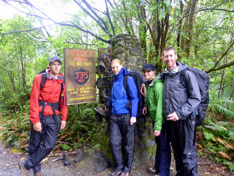
November 17th
Having had a great visit with Stew and Casey over the last week, it just worked out that they were headed up north to do a little more travelling, and we were headed south. So we said our goodbyes and watch as Stew nervously take on NZ roads on his own.
We made our way south from Queenstown to Invercargill. After stocking up on groceries there, we went to Bluff, a very windy town on one of the most southern tips of New Zealand (the most southern road at least).
1401km from Cape Reinga, the Northern most tip of New Zealand
There wasn’t much else to see in Bluff, so we made our way back into Invercargill for the night. This was one of the stormiest nights we have experienced in Bertie. The wind was ripping and Bertie got beaned with hail a few times throughout the night. As you can imagine, we got little sleep in between the wind gusts that would literally shake the van and the thumping of the hail on the roof.
November 18th
The next day we took the beautiful drive along the Catlins Coast. This is a beautiful stretch of road along the coast between Invercargill and Dunedin a region full of extensive farmland, native forests, and rugged ocean bays. The road itself wasn’t so nice as a lot of it was gravel, but the scenery was some of NZ’s best. Unfortunately we did not have great weather for it, but worth it.
Nikki getting blown away
Obviously wind is quite common in the area
Slope Point (NZ’s actual most southerly point)
Curio Bay, a bay of fossilised Jurasic-aged trees among the rock pools.
We were lucky enough to be here at low tide, which allowed us to go explore the interesting fossils. The stormy weather made for some great wave watching as they crashed up against the rocky bays.
We have really grown to love the ocean

The next attraction along the way was called Niagra Falls. It was just off the main road, so we figured we shouldn’t pass up the opportunity to see it.
This is NZ’s version of Niagra Falls. There was actually a sign posted explaining that the guy who named it had been to see Niagra Falls in Canada, and had a pretty good sense of humour when naming this one. Ohhh...Awww! 
Now... we came to NZ with some general expectations. Many of those were met early on, but there was still a couple major ones lingering over us. With only a couple weeks left, we were starting to feel like this one in particular would not be met. One of those things being that we would have to stop on the highway for farm animals (for example, run away sheep or a farmer moving them to another pasture).
Run away sheep skipping down the road.
Farmer moving his cattle.
Not even kidding you, these both happened within a hour of each other. I know it doesn’t seem exciting, but it was! The only classic NZ thing left on that list is to hit a possum. Ok... I know that sounds horrible, but if you saw how much road-kill there is here, you’d understand that it is part of the true Kiwi experience to hit one.
Next we stopped at Jack’s Blowhole. It was a 45 minute walk through farmland to get to it.
Scenery along the way to Jack’s Blowhole
In the middle of a sheep paddock, 200m inland from the sea and connected by a huge cave is a huge cauldron 55m deep, 144m long, and 68m wide.
Watching the waves crash up into Jack’s Blowhole
Then we made our way to Nugget Point, where there was a short walk to a lookout where the land steeply drops off into the ocean.
Nugget Point
We continued along to Kaka Point, where we found a sheltered camp kitchen to use to make dinner because it was still pretty stormy out. After dinner, having seen all the no camping signs all over Kaka Point, we decided to carry on to the next town, Balclutha. We found a quiet place near an athletic park to pull over for the night.
November 19th
We drove into Dunedin, the second biggest city on the south island. We went to their Saturday morning farmers market, where we enjoyed some delicious food (pork dumplings/samosa/cheese) and bought some fresh stuff for dinner (lamb sausage...yum).
Dunedin’s farmers market
Then we made our way into downtown Dunedin only to find Occupy Wall Street, Dunedin Edition.
Seems like all this guy could occupy was the ground.
After checking out the town, we decided to head to Dunedin’s beaches for some surfing.
Geared up and ready to go!
Yes, that is really Scott out there
Dunedin has the Guinness World Record for the steepest street in the world. We had to check it out.
We decided we didn’t want to put old Bertie through it, so we walked up ourselves leaving him at the bottom.
It was really steep! 18 degrees and 35% grade.
I wouldn’t want to live on this street.
Leaving Dunedin, we headed for a campground just out of town through a beautiful rocky gorge.
Another of the many beautiful drives we have done in NZ. We were happy to have some sunshine, as it seems we have been cursed with rain the last few days.
November 20th
In the morning we woke up to another grey rainy day. We went to Moeraki Boulders.
Big spherical boulders on the beach.

Just tinsy little rocks hey

Then we cut inland into Central Otago, toward a town called Omarama. We were just passing through, but saw a big sign for a “Merino County Hoe Down” and some big stampede style tents up, and about 100 RV’s in a great big field. The curiosity got the better of us so we turned around and went back to check it out. It ended up being a great big country music festival and BBQ. Which would have been cool if we like country music and were 70 years old.

Not even kidding you, the average age of the people attending this thing was probably 75.
After making some lunch here, we continued on to Lake Pukaki.
 There are a bunch of dams in the area that provide one fifth of NZ power.

Lake Pukaki.
On a clear day, this is the perfect spot to view Mt Cook, NZ’s highest mountain. Unfortunately for us, it was completely socked in and we couldn’t see it at all.
Sad
Even though it was cloudy, it was still a pretty drive.

Then we stopped at Lake Tekapo, another beautiful glacier lake along the way.

Lake Tekapo.
The beautiful color of this lake is due to rock flour in the water which was created when a stony-bottomed glacier moved across the land. The grinding action created fine particles that ended up being suspended in the glacial melt water, creating this beautiful milky turquoise color.
It is here that they have an amazing Observatory where you can go look at stars at night. Again, unfortunately for us, there was no use for this as it was completely clouded over and only expected to get worse.
So, instead we went to the Hot Springs where we enjoyed a long hot sauna and hot pool soak. Followed by a much needed shower ;) You take any shower you can get when you live in a van and haven’t had a shower in the last 3 days.
We read about a campsite just a little ways away from Lake Tekapo and decided to head there for the night. One thing we have noticed about NZ is that the signage for things can be very poor at times. You really have to pay attention if you want to catch the turnoff. We must have missed the campsite (or... we still both think it didn’t even really exist), because we ended up in the next town, Geraldine. Not wanting to retrace our path, we decided to just stay there for the night.
So, freedom camping in NZ has become a little bit harder since the laws have become stickier. But, we had yet to have any issues or a knock on the window in the middle of the night. So, we pulled over by a park, cooked some dinner, and settled in for bed later in the night. Just as we were drifting off to sleep...
Knock Knock Knock.
Nikki: Uh Oh! Don’t move!
Knock Knock Knock “You can’t stay here”
We still didn’t move...
“I’m taking your numbers and you’ll get a fine if you stay here”
Having not heard a car drive up, or drive away, we peaked out the window and the man had left. We looked around and realized that we were parked just outside of the Motor camp, and that was probably the manager of the Motor camp. We decided we would move down to another block. Sure enough, we slept uninterrupted the rest of the night.
In the last few days, we saw a lot of the country. Unfortunately it was rainy and cloudy a lot of the time, but we still made the most of it and saw as much as we could. But... we are ready for a break from the rain and hoping for some sunshine in the next few days.

Friday, November 18, 2011

The Finest Walk In The World

November 10th – November 16th
QUEENSTOWN/MILFORD SOUND
November 10th and 11th
After making it from Wanaka to Queenstown, we checked into the Black Sheep Lodge. After getting a few things figured out, we picked up Stew and Casey from the Queenstown airport in the afternoon. We caught up over lunch and spent the rest of the day checking out Queenstown. It is a very touristy spot, which is not surprising because this is the adrenaline center of New Zealand. But overall, a pretty cool spot. It is a small adventurous town set along a lake in a valley with some massive mountains surrounding it (kind of reminds us a little bit of Banff).
We spent most of the next day preparing for our Milford Sound Track, which we were to start the next day. We figured out how to pack enough food for the four of us for a 4-day trek (which shouldn’t be so difficult except that it is the Wilson brothers that needed to be fed... so it becomes more like packing food for at least 6). Anyways, we packed up all our bags and were ready to go for the morning.
November 12th
We woke up bright and early, jumped into Bertie (yes, all 4 of us squished in), and made our way to Te Anau by 9:30am. We were supposed to catch a bus at 9:45am, but when we got there, we were changed to a bus that left at 1:45pm. So we had some time to grab some breakfast and chill out for a few hours in the kind of sleepy town. We ended up reading/napping in Bertie for a while.
At 1:45pm, we caught the bus to Te Anau Downs, where we caught a boat which took us across Lake Te Anua (the second largest lake in NZ) to the start of the Milford Track, which is apparently known as the “Finest walk in the world”.

Washing off the Dydimo from our shoes before starting the track

Here we go!
Day 1 Glade Wharf to Clinton Hut (5km in just over 1 hour)
The hike to the first hut was very short, only just over 1 hour through very easy, flat terrain in a beech forest along the Clinton River.
Stew and Nikki starting out on Day 1
Quick side trip along the way to the wetland area.
Giant beech tree
We arrived at the hut at about 3:30pm. Played some card games until we were hungry for dinner. We warmed up the very spicy chilli for dinner and played some more games after dinner until calling it a night and heading to bed.
Clinton Hut

November 13th
Day 2 Clinton Hut to Mintaro Hut (16.5km in 6 hours)
The track continues along Clinton River, which has some of the clearest water we’ve seen (it is so clean they actually use it as drinking water in the huts, unfiltered).
Clinton River
We stopped at Dead Lake for some lunch. It was located just at the base of a steep mountain side that had some beautiful waterfalls streaming down its face.
Quick stop for lunch, after loading on the bug spray.
Dead Lake
Scott and Stew
Enjoying the views. We were lucky to have beautiful weather so far.
We then crossed an open prairie area where we climbed slowly up to Marlene’s Creek, which in heavy rainfall can apparently be impassable (luckily, we didn’t have that issue). This area gets about 9m of rainfall per year, and in heavy rain, the water levels can rise 1m/hr. It hadn’t rained much recently, and as you can see, there is very little water here now. It’s hard to imagine this creek rising higher than the bridge, making it impassable in heavy rain.
Scott shouldn't have much difficulty crossing the creek.
Another creek along the way
One of many waterfalls
We continued along the track, slowly gaining a little elevation, until we came to Mintaro Hut, where we would spend the night.  
Mintaro Hut

November 14th
Day 3 Mintaro Hut to Dumpling Hut/MacKinnon Pass (14km in 8 hours)
The track got straight to business today, quickly turning into well-graded zig-zag switchbacks which continued along for about 2 hours, slowly making our way up MacKinnon Pass.
Zig-Zag, Zig-Zag, Zig-Zag
Almost there! (So tired of zig-zags)
First spotting of snow along the way at about 1000m
We made it to the top and were rewarded with some of the most stunning views any of us have seen.
View from MacKinnon Pass
Way to go team
Scott dangling his feet off the cliff
We were warned by the hut wardens about the Kea birds in the area. We had seen them earlier in the track, but this was our first real experience with them. They are a very clever type of parrot native to NZ. They have been known to steal anything they can get their beaks on, and can even open up zippers on the backpacks. One sneaky little Kea came along and decided to check our bags out, with us standing right there.
We all stood close by watching to see what he could do. And yes, he can open zippers. He was quickly shooed away, and flew over to the next group of backpacks to see what he could get away with.

Just when we thought we were done with the climbing, we found out we had just a little more to go. We continued upward for about another 20 minutes to the highest point on the track (1154m).

At the highest point there is an outhouse. It is a famous outhouse. Only because it has one of the best views in the area.
Loo with a view

After checking out the view, we started our way back down the mountain, knowing we had about 900m of elevation to loose.

Crossing over some snow

We came across some massive snow caves along the way
The descent was brutal. The regular track was closed because of avalanche damage to the track, so we were detoured along the emergency track. Instead of the track falling gently downwards, it zig-zagged steeply down, making it really hard on our knees and feet.
At the very base of the mountain, there was a short 1 and a half hour side trip where you could drop your bags and walk up to Sutherland Falls, the 4th highest waterfall in the world. We were tired and sore, but we toughed it out and took advantage of the break from carrying our bags.
Stew and Casey at Sutherland Falls
With our packs back on, we had another hour and a half until we reached Dumpling Hut. We made some delicious pasta for dinner, which was well-deserved after such a tough long day of hiking (with the extra hike to the falls, we were hiking for 9 and a half hours today). It was a good thing the views were spectacular making it very worth the effort. 
After dinner we were all beat and headed straight for bed.
November 15th
Day 4 Dumpling Hut to Sandfly Point (18km in 6 hours)
We had to wake up early this morning because we had a boat to catch at 2pm. With 18km to hike, we left at about 7:30am. It was overcast and a little chilly, but not raining yet.
The track follows along Arthur River, another perfectly clear water source.
Another waterfall along the way
It started raining a couple hours later, so we got all dressed up in our rain gear and kept on truckin. We have heard many times that this track is most beautiful when it is raining, as it makes the waterfalls even more pronounced. Even though we may have missed out on that aspect of it, we were all grateful to have had beautiful warm sunny days for the past three days. One day of rain was not so bad.

Bell Rock from the outside
Bell Rock from the inside. A bell shaped rock, hollow enough inside for us to stand up in it.
The track then reached Lake Ada and climbed up along the rock cuttings, which were blasted and hand cut when the track was first made.
Making our way up along the rock cuttings above Lake Ada.
We made it to Sandfly Point with just 15 minutes to spare before we needed to board the boat. The Sandflies were horrendous, as the name implies, but luckily there was a shelter we could sit in for the few minutes we had to wait.  
We just hiked 55km! I think we are all feeling a little stunned still at this point (Scott especially)
We took the boat across to Milford Sound. It was pouring rain and the visibility wasn’t great, but the Fiords that we could see were absolutely amazing. Great big mountains shooting straight up from the water.
Milford Sound Fiords
Milford Sound Waterfall
If it had been nice out, we were planning on going on a cruise on Milford Sound, but since it was yucky out, we decided to catch the earlier bus to Te Anua instead. When we arrived there, we were all hurting, tired, and hungry. We grabbed some greasy food at a pub in town, meeting up with Robert and Doris there as well. Then we drove back to Queenstown and made our way back to the Black Sheep Lodge, looking forward to a nice hot shower and a comfy bed.
November 16th
After a glorious hot shower in the morning (because Stew and Casey beat us to the showers last night and took all the hot water) we booked our adventure for the day. We spent the rest of the morning trying not to think too much about what we were about to do.
At 12:20pm, we walked downtown to the NZONE office. We signed our life away, and then all jumped into a van and drove us 20 minutes outside of town.
Getting psyched to go
Who looks more nervous?
We got all geared up in our suits, helmet, goggles, and harnesses. Then we were given a super quick safety briefing and away we went to board the plane...
Casey and Nikki were at the back of the plane, and Scott and Stew were near the front (It didn’t take us too long to figure out what that meant for Casey and Nikki).
Anticipation at its finest
The plane took off and we started climbing higher and higher. Once at 12000 ft, the door opened and people very quickly started disappearing from the plane!
SKYDIVING!

 Amazing!
Sorry Moms, we weren’t about to tell you about this one before it happened.
You are strapped to a skydiver who has jumped over 1000 times in his life, with another skydiver with a camera strapped to his helmet that jumps with you as well.
That first feeling when you are basically hanging out of the plane just before you jump is unreal. Then the guy you are attached to sways back and forth three times and you are all the sudden free falling 12000 ft above ground.
Nikki’s skydiver was quite adventurous and did a little flip just after jumping out of the plane. Eeeek!
Yes... that is a real smile!


We were falling at a speed of 200km/hr which lasted for about 45 seconds, and then the chute opened when we were around 6000 ft.

We glided, swirled, twisted and floated our way down to the landing area, enjoying the absolutely stunning views of the mountains, the lake, and Queenstown.
 Beautiful views


The landing was surprisingly smooth.


WE JUST JUMPED OUT OF A PLANE!


Once the slight feeling of nausea subsided, we were taken back to the town where we continued to come down from the adrenaline.
The only effect that anyone had was that Nikki’s ears would not re-pressurize for a couple hours. So she walked around downtown for a while not being able to hear much at all. Then finally her ears popped and she could hear again.
Don’t worry Mom, Scott is still without hospital visit this trip. (Knock on wood).